We all use maps and visitor guides to orientate and navigate around museums, parks, towns, transport systems, etc. A quality map or visitor guide will assist with this orientation and navigation process. However, a poorly designed one will confuse, conflict and result in the wrong decisions in getting to a destination and how to get around. So what are the important factors when designing a map or a floor plan? A good point of reference is a design principle known as “Wayfinding” – a process of using spatial and environmental information to navigate to a destination. Wayfinding has four distinct components, namely orientation, route destination, route monitoring and destination recognition. Maps together with signage, or other visual landmarks, should be used in tandem to determine one’s location, decide the best way to go (e.g. the quickest or most interesting), monitor progress along the given route and provide an indication of the destination. Good maps or visitor guides should include necessary landmarks, clear and constant labeling and easy to follow colour schemes.
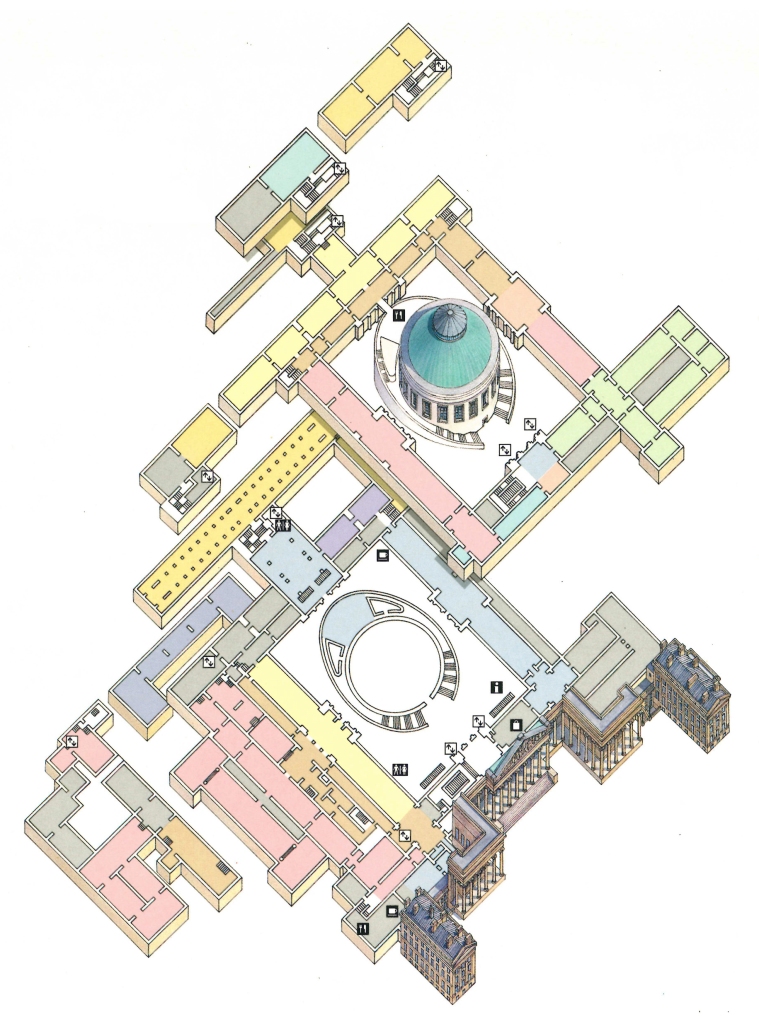
The floor plan below is part of a visitor guide to the British Museum in London. The illustration of the façade at the front of the museum gives the visitor a sense of orientation. The colour coding and numbering is used to aid navigation and route monitoring. The visitor may quickly determine where they wish to go, how they might get there and are likely to recognize the destination once they arrive there. 
Floor plan illustration for the British Museum, London. Created for the Eyewitness Travel Guide to Great Britain in 2000. Illustration: Gary Cross. © Dorling Kindersley Limited, London.
Schematic maps are often designed to represent travel networks in large cities. Careful colour coding of individual lines, use of icons and clear and consistent labeling is hugely important to enable travellers to navigate through these highly complex and potentially stressful transport networks. Here are the highly effective schematic maps for two of the most complex subway systems in the world – the London Underground and the Tokyo metro.
A plan is currently being considered that would harmonize transit links within the Greater Toronto and Hamilton Area (GTHA). Transit wayfinding would be used to ensure the consistent use of signage, graphics, visual and audio cues as well as numbering and naming of stations and stops across all transit areas within the GTHA. The UK based design consultancy applied has been commissioned to undertake the project. More information on transit wayfinding can be found on the Metrolinx website.